A rare late-June snowstorm is taking aim at the Northern Rockies today, Friday June 26, 2026, and the mountain roads leading to Yellowstone, Grand Teton, and Glacier are squarely in its path. Up to 8 inches of wet, heavy snow could pile up on the highest passes above 6,000 feet from Saturday night into Monday, just as a separate flash flooding threat sets up across central Idaho and western Montana and temperatures crash as much as 50 degrees into a genuine summer freeze.
Forecasters at the National Weather Service in Missoula are warning of mountain snow, flooding rivers, and an all-around hypothermia risk for anyone caught unprepared in the high country.
Peak Danger Window
Overnight through mid-morning Saturday night into Monday, when snow levels bottom out, pass summits turn to slush and ice, and backcountry temperatures drop below freezing.
What to Expect
- Snow totals: Several inches to 8 inches of wet, heavy snow above 6,000 feet in western Montana and Idaho, and above 8,000 feet in northwest Wyoming
- Where it sticks: Snow accumulates fastest on grassy surfaces. Warm pavement from this week’s heat will limit road accumulation during the day but not overnight or at the highest summits
- The freeze: Overnight lows in the 30s across the Northern Rockies and Great Basin, with daily record lows possible in parts of eastern Oregon and Idaho and a summer frost or freeze in higher elevation cold spots
- The whiplash: High country valleys that sat in the 80s and 90s earlier this week may not climb out of the 40s and 50s, with morning lows in the 40s even in Boise, Reno, and the Salt Lake Valley
The setup is a slow-moving upper low dropping south behind a Friday cold front, per The Weather Channel. Because the low centers south of Interstate 90, the lowest snow levels set up across the Bitterroot, Sapphire, and Anaconda-Pintlar ranges and along the Continental Divide. This same system already prompted an earlier Autoblog winter storm watch alert for the Idaho and West Yellowstone mountain passes.
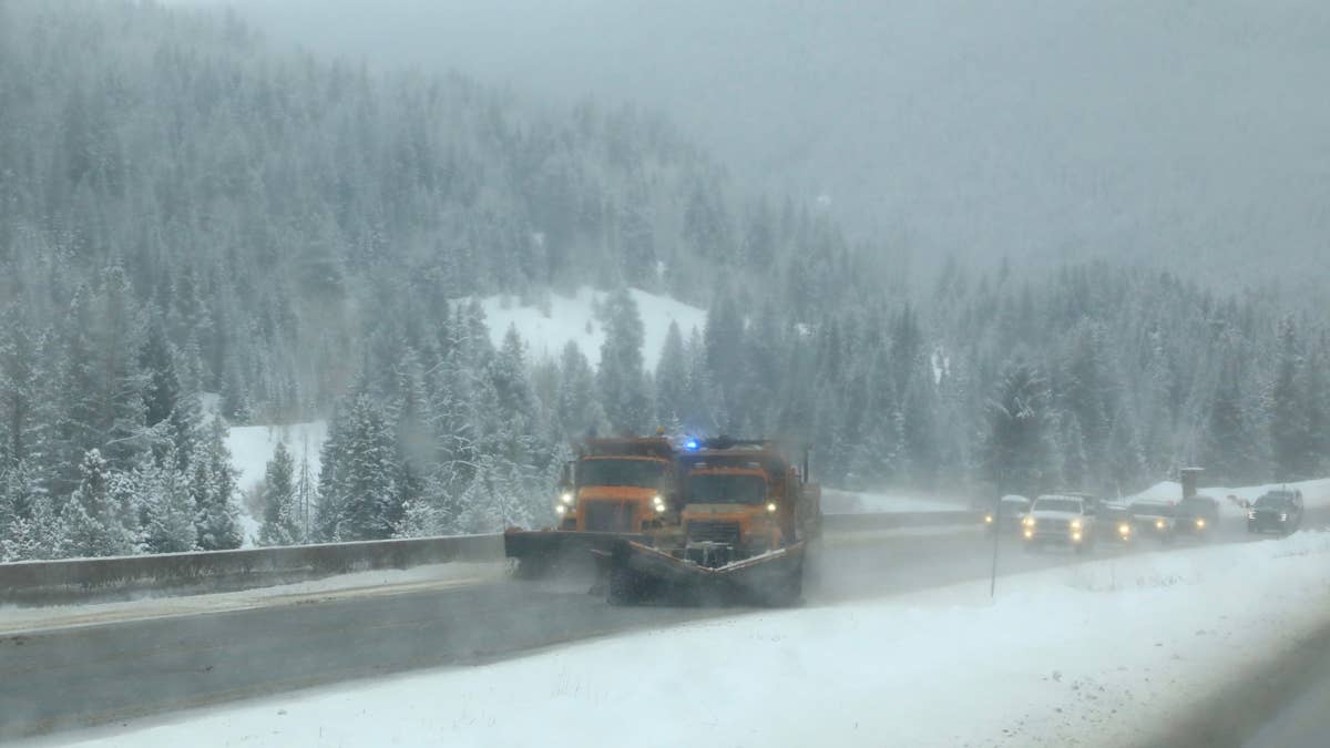
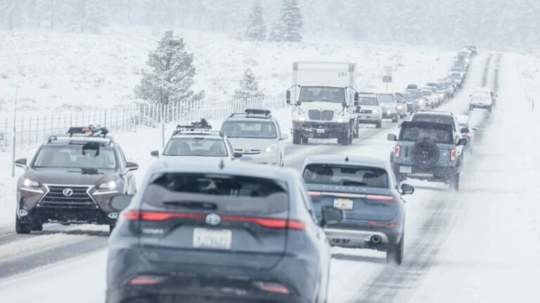
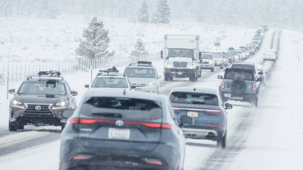
Road Conditions
The mountain roads feeding the national parks are the headline travel concern, and the risk rises with elevation. The single most exposed park route is US 20 over Targhee Pass (7,072 feet), the main approach to the busy West Yellowstone entrance, where accumulating snow could meet heavy summer tourist traffic overnight. In Glacier, the newly reopened Going-to-the-Sun Road tops out at Logan Pass (6,646 feet), and the NWS specifically flags Glacier for the toughest conditions late Sunday into Tuesday, with slush and ice possible over the summit.
Along the Montana-Idaho border, US 93 over Lost Trail Pass (around 7,000 feet) sits deep in the favored snow zone, and Monida Pass on Interstate 15 (6,823 feet) is the only Interstate-grade crossing genuinely in play for snow, which makes it the most consequential for through traffic and freight. Higher and more remote, Lemhi Pass (7,373 feet), the unpaved Continental Divide track Lewis and Clark crossed in 1805, and the climbing stretches of Idaho Highway 28 between Tendoy and Lone Pine will be among the first to go to mud, then snow.
Even where snow does not stick, the bigger danger in central Idaho is water: US 12 over Lolo Pass and the Salmon River corridor face flooding and rapidly rising streams. Knowing the difference between AWD and 4WD matters before any of these crossings, and Autoblog’s breakdown of what each system actually does is worth a read, because neither one shortens your stopping distance on ice.
Danger to Hikers and Campers
The deadliest risk this weekend may not be on the road at all. The NWS is calling out an explicit hypothermia threat for anyone in the backcountry who cannot stay dry, and that warning is aimed directly at the thousands of summer hikers, campers, and backpackers in Yellowstone, Grand Teton, and Glacier during peak season.
Cold, wind-driven rain at lower elevations and wet snow higher up, combined with overnight temperatures below freezing, is a textbook hypothermia setup, especially for visitors who arrived dressed for 90-degree heat. Rapidly rising rivers and small streams add a drowning and stranding risk along popular corridors like the Salmon River. If you are camping or hiking this weekend, dress for winter, pack rain gear and insulating layers, and seriously consider delaying or canceling backcountry plans until the system clears Monday or Tuesday. Check park websites for road and trail status before you go.
Winter Driving Tips
If you are driving any high pass this weekend, your tires are the single most important variable, even in late June. AWD helps you get moving on snow but does nothing to shorten your stopping distance on ice, which is the real threat on shaded pass summits overnight. Carry chains, a blanket, a flashlight, a portable charger, water, food, and a full tank of fuel before any crossing, because these are remote routes with long gaps between services. Give yourself at least triple the stopping distance you would use on dry pavement. If your vehicle is set up for summer and you are suddenly facing winter, Autoblog’s roundup of the best cars and SUVs for snow and winter driving is worth a look, and our best practices for driving in snow, ice, and rain guide covers everything from skid recovery to what to keep in your trunk. Check Idaho 511 and Montana’s travel info map for live closures before you leave.
Timing
The cold front sweeps through Friday, with snow beginning in the Bitterroot, Sapphire, and Anaconda-Pintlar ranges and along the Continental Divide by Sunday morning. The system is slow-moving and lingers through the weekend, with the heaviest precipitation reaching northwest Montana on Monday as the upper low tracks directly overhead. Glacier will see deteriorating conditions starting Saturday, with the worst late Sunday into Tuesday. Conditions should gradually improve by midweek as the low pulls east. We’ll update this article as conditions evolve.