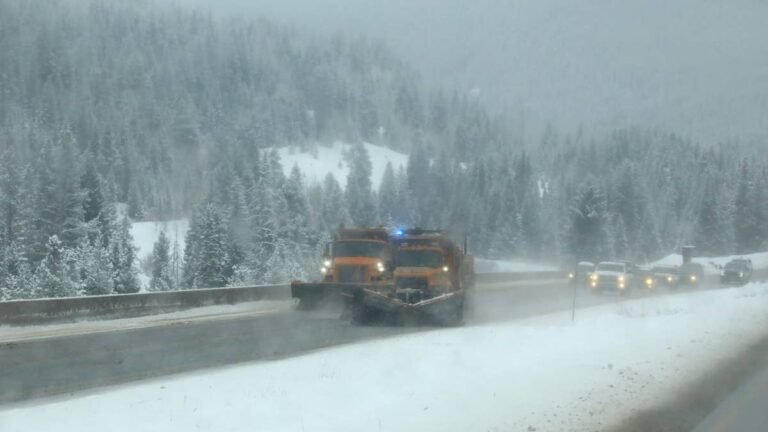
Up to 12 inches of snow is forecast for the high country from 8 p.m. ET Tuesday under winter weather advisories from the National Weather Service, with the heaviest totals above 4,000 feet. Forecasters expect the snow level to keep dropping overnight, so some of the passes taking rain when the advisories begin could see snow by Wednesday morning.
Snow Totals For The Washington Cascades
Three NWS forecast offices cover the range, and all three advisories run from 8 p.m. ET Tuesday to 8 p.m. ET Wednesday. The largest totals sit in the Cascades of Pierce and Lewis counties, where the NWS Seattle winter weather advisory calls for 6 to 12 inches across Paradise, Mount Rainier, White Pass and Crystal Mountain. The same office expects 4 to 8 inches from Mount Baker south to Stevens Pass, and 3 to 8 inches above 4,000 feet in southern King County, though Snoqualmie Pass itself is forecast for only 1 to 3 inches with rain mixing in at times.
East of the crest, the NWS Spokane winter weather advisory puts 2 to 8 inches above 3,000 feet over Washington Pass, Loup Loup Pass, Holden Village and Stevens Pass, with the highest amounts along the crest. Farther south, the NWS Pendleton winter weather advisory covers the upper eastern slopes around Roslyn and Easton with 3 to 7 inches above 4,000 feet and periods of moderate to heavy snow.
How Falling Snow Levels Change Pass Driving Overnight
Spokane gives the clearest timeline, with a snow level near 4,000 feet on Tuesday evening falling to between 2,500 and 3,000 feet by Wednesday morning. That drop could bring snow to lower passes overnight. Snow is expected at higher elevations from the start of the advisories, with Stevens Pass named in two separate products and White Pass inside the zone with the largest totals.
Snoqualmie Pass, the I-90 crossing and the busiest route over the range, sits lower than the other major passes, and forecasters single it out for the smallest amounts and a rain and snow mix. The Spokane snow level figures cover the eastern slopes rather than Snoqualmie, but if a similar drop reaches the I-90 summit overnight, Wednesday morning traffic could meet snow on pavement that was wet a few hours earlier.
What It Means For Round Trips Across The Cascades
Washington posts traction and chain requirements pass by pass, and they can change between an outbound crossing on Tuesday evening and a return on Wednesday, so the advisories send drivers to the WSDOT travel page for current conditions.
The Spokane advisory also names Washington Pass on SR 20, the North Cascades Highway, which fully reopened on June 14 after repairs to damage from last winter’s storms. WSDOT closes the highway every winter because of avalanche risk, with the date set by conditions rather than the calendar, so its pass page is worth checking before any trip planned across the northern Cascades this week.