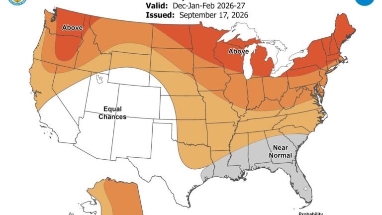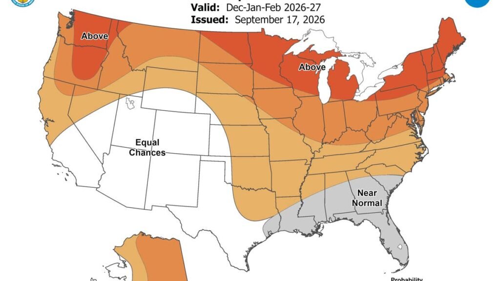
Winter is still a couple of months off, but the National Weather Service‘s Climate Prediction Center already gives drivers an early look with its newest September outlook, which covers December, January and February, the three months of meteorological winter.
A seasonal outlook assigns odds rather than forecasting storms, and plenty can change before December. Still, El Niño is on track to become one of the strongest on record, and forecasters leaned heavily on it in drawing this map.
The Southwest And Southeast Are The Coldest Parts Of The Map
No part of the Lower 48 is favored to run below normal, so the coldest parts of this map are the ones least tilted toward warmth. There are two.
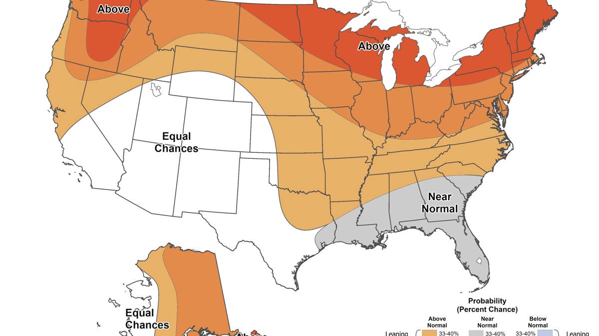
NOAA Climate Prediction Center
The Southwest, from central and southern California across Nevada, Utah, Arizona, Colorado and New Mexico, is at equal chances, meaning forecasters see no lean toward a warm, normal or cold winter. Those states are the closest this outlook comes to a cold forecast.
The Southeast is favored to run near normal from Louisiana through Mississippi, Alabama and Florida, and the zone reaches up into southern and central Georgia and coastal South Carolina. See the full NOAA temperature map here. CPC’s discussion describes it as a tug of war between the cooler signal El Niño usually brings to the region in winter and a long run of milder winters. The same region has the highest odds of above normal precipitation in the country, and with temperatures there still above freezing on most winter days, that points to rain, with ice possible when the vertical temperature profile lines up.
The outlook measures each region against its own normal, so Minneapolis will still run far colder than Mobile in absolute terms.
Where Are The Odds Of A Colder Winter Highest?
The map does not print the odds of a colder than normal winter, but NOAA’s method makes them easy to estimate. Every outlook starts each outcome, warm, normal or cold, at one in three. Where warm is favored, the chance of cold shrinks, and where near normal is favored, warm and cold shrink by the same amount.
That puts the best chance of a colder than normal winter in the Southwest, at roughly one in three, with the Southeast close behind. Across the northern tier, where the warm lean is strongest, it drops as low as one in fifteen.
A mild season can still bring hard cold. CPC flags the chance of one or more cold air outbreaks across the northwestern quarter of the Lower 48, while noting that a few cold snaps are unlikely to move a three month average.
What It Means For Drivers
The two coldest parts of the map share a problem that has nothing to do with snow. Much of the inland Southeast still sees mornings at or below freezing in a near normal winter, and the high country of the Southwest spends most winter nights below freezing. At 32 degrees Fahrenheit a car battery loses about 30 percent of its strength, according to AAA, which recommends having the battery tested before winter sets in.
Most Of The Country Leans Warm
Everywhere else, above normal temperatures are favored. The strongest warm lean runs across the northern tier from North Dakota and Minnesota through the Great Lakes, New York and New England, with a second pocket over eastern Washington, northeastern Oregon and the Idaho panhandle. Montana and the Pacific Northwest coast lean warm as well, but less strongly, which CPC links to a negative Pacific Decadal Oscillation and slightly cooler water that may influence parts of the West Coast.
For now, the outlook points to a warm leaning winter across most of the country, with the Southwest holding the best odds of a colder than normal season and the Southeast close to average. The next temperature outlook is due Oct. 15, alongside NOAA’s annual winter outlook.