A late-season trough is set to dig into the Western U.S. next week, delivering heavy snow to the higher elevations of Colorado and Wyoming. The Weather Prediction Center’s extended forecast discussion issued today, Friday May 15, 2026, flags Mon May 18 through Fri May 22 as the active window, citing “a strong trough over the Rockies” as the driver. NWS Boulder and Cheyenne have not yet issued operational Winter Storm products.
Peak Driving Danger Window
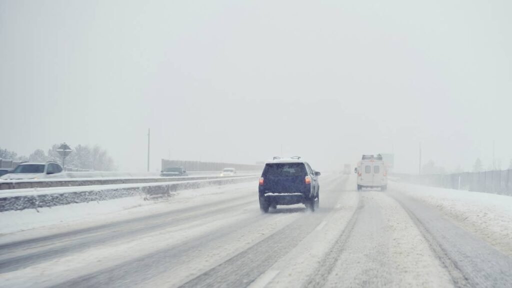
Tuesday night into Wednesday morning, May 19 and 20, looks like the worst window for I-70 mountain corridor traffic, with snow levels crashing below 9,000 feet as the trough’s coldest air interacts with Pacific moisture over the Continental Divide.
What to Expect
- Active window: Mon May 18 through Fri May 22, 2026
- Geographic scope: Northern and southern Colorado mountains above roughly 9,000 feet, Wyoming’s Snowy Range and Medicine Bow, and the Rocky Mountain National Park higher terrain
- Headline threat: Heavy snow per WPC, with specific accumulation ranges pending from NWS Boulder and Cheyenne
- Secondary threat: Strong cross-trough flow typically supports 35 to 55 mph gusts at exposed passes
This is the second major spring trough to target the Rockies this month, following the May 4-7 storm that produced isolated 30-inch totals near Estes Park and the Medicine Bow Range. The current setup is driven by an amplified upper-level pattern, with an anomalous ridge over the East Coast and the Rockies trough sharpening underneath it.
Road Conditions
The exposure list is familiar from earlier this month: I-70 through the Eisenhower Tunnel and Vail Pass, US-40 over Berthoud Pass and Rabbit Ears, US-285 across Kenosha Pass, US-34 across Trail Ridge Road in Rocky Mountain National Park (which reopens in late May and is highly weather-dependent), and I-80 over the Summit between Cheyenne and Laramie. Wet pavement above 8,000 feet refreezes hard overnight in mid-May, and any traction law activation by CDOT will hit on short notice. Check COtrip.org before crossing the Divide.
Winter Driving Tips
Late-season Rocky Mountain snow is a tire problem first and a driver-discipline problem second. Three-Peak Mountain Snowflake (3PMSF) tires are the minimum for elevation gain above 8,000 feet, with tread depth at or above 4/32 inch. Cold-soak pressure loss runs roughly 1 to 2 PSI per 10 degree drop, so a vehicle that left Denver at 70F may sit 4 to 6 PSI light at the summit. Triple your stopping distance on snowpack and never use cruise control on ice. For more, see Autoblog’s best vehicles for snow and ice and snow and ice driving practices guides, plus CDOT’s chain law page.
Timing
The WPC active window opens 12Z Mon May 18 and runs through 12Z Fri May 22, 2026. NWS Boulder and Cheyenne are the offices to watch for Winter Storm Watch or Warning issuance over the weekend. Behind the trough, WPC’s broader pattern shows a strong cold front pushing severe storms across the Plains and Midwest while an early-season East Coast heat wave builds simultaneously. We’ll update this article as conditions evolve.