A late-season winter storm is set to bury the Northern Sierra Nevada under feet of snow this weekend, prompting the National Weather Service in Sacramento to issue a Winter Storm Watch for the west slope and Western Plumas County above 4,500 feet. The heaviest impacts are expected from late Friday evening through Sunday afternoon.
What to Expect
The NWS is forecasting 12 to 24 inches of snow above 4,500 feet, with 36 to 48 inches possible at the highest peaks. Snow levels will start relatively high Friday night, around 6,000 to 7,000 feet, before dropping sharply to 4,000 to 4,500 feet by late Saturday into Sunday as colder air filters in behind the second, stronger low. Wind gusts up to 45 MPH will compound the snowfall, reducing visibility across exposed passes and ridgelines.
The most intense accumulation window runs from Saturday morning through midday Sunday. Drivers on I-80 over Donner Pass, US-50 over Echo Summit, and routes including CA-88 at Carson Pass and CA-89 should anticipate chain controls and the possibility of full closures during the heaviest snowfall rates.
Road Conditions
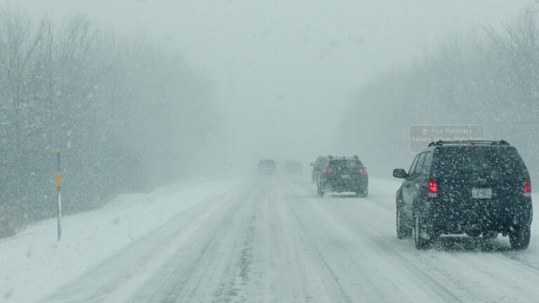
Chain controls on I-80 are virtually certain once snow levels drop below 6,000 feet Saturday evening, and Caltrans may implement full closures over Donner Summit if snowfall rates and visibility deteriorate beyond manageable thresholds. Wet, heavy spring snow will pack onto road surfaces faster than midwinter powder, overwhelming plows during peak intensity. Secondary mountain roads will become impassable quickly. Caltrans recommends checking QuickMap or calling 511 before attempting any Sierra crossing this weekend.
Winter Driving Tips
Late-season Sierra storms catch drivers off guard because many have already removed winter gear from their vehicles. If you must cross the mountains this weekend, carry chains even if you drive an AWD vehicle; chain controls do not exempt AWD when Caltrans moves to R-3 restrictions. Heavy, wet spring snow reduces visibility faster than lighter midwinter powder, and it packs onto windshields and roofs quickly, so clear your entire vehicle before driving.
Stock your trunk with an emergency kit including a phone charger, blanket, water, and a shovel. For a full breakdown on handling snow, ice, and rain behind the wheel, review Autoblog’s guide to best practices for winter driving. The safest move is to delay any Sierra crossing until Sunday evening at the earliest, once the second low clears and Caltrans crews have time to treat and reopen passes.
Timing
Snow begins Friday evening and intensifies sharply Saturday morning. The worst window for travel runs from Saturday predawn through Sunday afternoon. Conditions should begin improving Sunday evening as the system pushes east, but overnight refreezing will keep mountain roads hazardous into Monday morning. If your schedule allows, hold off until Monday midday for the safest crossing.