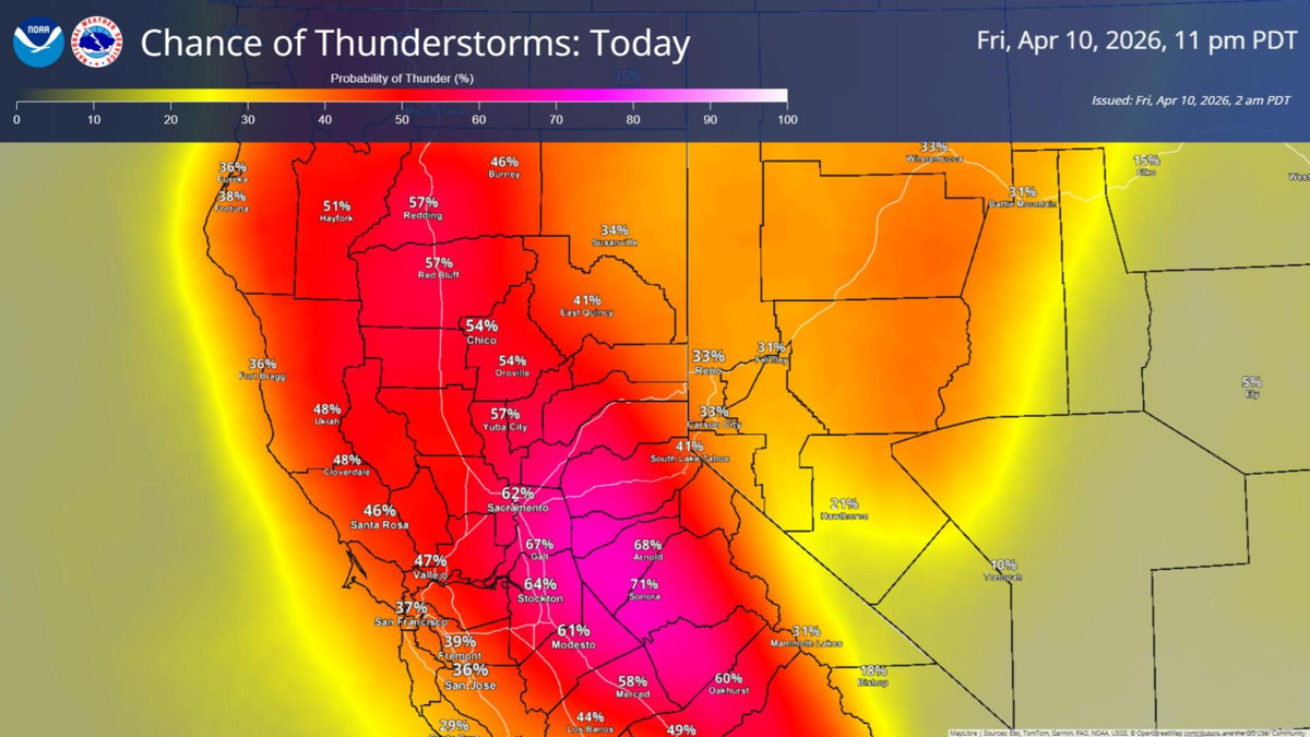
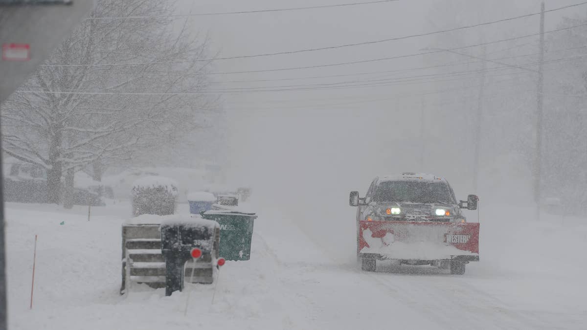
If you need to cross the Sierra this weekend, today is your last realistic window. The National Weather Service has a Winter Storm Warning active for Mono County and the Donner Pass area, with watches across the Northern Sierra, and what is heading for the mountains starting Friday evening is not a routine spring snow event. Two Pacific systems are stacking back-to-back. The second is stronger. Snow totals above 7,000 feet could reach 28 inches near Lake Tahoe and up to four feet on the highest peaks. Wind gusts along the Sierra crest are forecast at 70 to 80 mph. The NWS says travel “could be very difficult to impossible.”
I-80 over Donner Pass, Highway 50 to Lake Tahoe and Highway 395 along the eastern Sierra are all in the direct path. Chain controls are virtually guaranteed. Full closures are on the table, and I-80 already shut down for 60 miles during a similar system in February. If you do not need to be on the other side of the mountains before Monday, do not go.
The Storm
A lead upper low moves ashore Friday night. A stronger, more compact closed low follows Saturday night into Sunday. Together they will push moisture anomalies in the 90th to 95th percentile into the Sierra, and the slow movement of the upper low means the snow keeps falling for roughly 48 hours.
The critical detail for drivers is the snow level. It starts above 9,000 feet on Friday, which means the passes initially get rain. Then it drops. By Saturday evening snow levels fall to 6,000 to 7,000 feet. By late Saturday into Sunday morning they crash to 4,000 to 4,500 feet. That means snow at the level of foothill communities and heavy accumulation at every pass in the Sierra. People who drove over Donner in sunshine on Thursday will not recognise the road by Saturday night. The heaviest period is forecast from late Saturday morning through midday Sunday.
Zone Forecasts
Mono County (NWS Reno, Winter Storm Warning): 2 to 6 inches west of Highway 395. 6 to 12 inches above 8,000 feet. Up to 24 inches along the Sierra crest. Winds gusting 70 to 80 mph on the crest, up to 40 mph along 395. Friday evening through Sunday evening.
Lake Tahoe area (NWS Reno): 6 to 10 inches around the lake and up to 7,000 feet. 12 to 28 inches above 7,000 feet and along Sierra passes.
Northern Sierra / Western Plumas County (NWS Sacramento, Winter Storm Watch): 1 to 2 feet above 4,500 feet. 3 to 4 feet on the highest peaks. Light accumulations of 2 to 4 inches possible as low as 4,000 feet. Winds up to 45 mph. Heaviest snow late Saturday morning through midday Sunday.
The Highways
I-80 overDonner Pass (roughly 7,000 feet). The primary east-west corridor across the Northern Sierra. With 12 to 28 inches forecast at pass elevation and winds gusting above 45 mph, chain controls will be in effect at minimum. In February a similar system shut down a 60-mile stretch of I-80 and stranded hundreds of drivers for hours. Expect chain controls beginning Saturday with possible closure Saturday night through Sunday.
Highway 50 to South Lake Tahoe. Echo Summit sits at 7,382 feet, squarely in the heavy snow zone. Highway 50 has the same closure risk as I-80 and fewer plowing resources. When both routes close simultaneously there is no realistic alternative across the central Sierra. That happened in February too.
Highway 395 (Eastern Sierra). The Warning specifically names 395 with gusts to 40 mph and 2 to 6 inches of snow. Higher terrain west of 395 faces 6 to 12 inches, which makes side roads to Mammoth Mountain and June Mountain treacherous.Highway 88 through Carson Pass (8,574 feet) and Highway 89. Both exposed to heavy snow and high winds with limited plowing resources. These are typically among the first routes to close and the last to reopen, and nobody should be counting on them this weekend.
US NWS![]()
When To Drive
Friday daytime (today). Your last safe window. Snow levels remain above pass level through Friday afternoon. If you need to be on the other side this weekend, go now.
Friday evening. Storm arrives. Rain transitions to snow at higher elevations. Chain controls begin.
Saturday. Conditions deteriorate through the day. Snow levels drop, winds increase, and by evening you are looking at heavy snow above 6,000 to 7,000 feet. Not a good day to be on a mountain highway if you have a choice.
Saturday night through Sunday morning. The worst window. Snow levels crash to 4,000 to 4,500 feet. The stronger second system arrives. Crest winds hit 70 to 80 mph. Pass-level gusts reach 40 to 45 mph. Visibility could go to near zero. This is when closures are most likely.
Sunday afternoon onward. Storm weakens. But do not assume roads reopen quickly. Clearing 1 to 2 feet of snow off a mountain highway takes hours even after the snow stops.
Why This Storm Is Different
The Sierra gets spring snow. That is not news. What makes this one worth paying attention to is the wind. 70 to 80 mph on the crest is not a spring number. Those speeds create whiteout conditions, knock down trees and power lines, and make high-profile vehicles undrivable on exposed passes. On top of that, the snow level drop is unusually large. Starting above 9,000 feet and falling to 4,000 means communities that normally get rain from this kind of system will get snow instead, and the passes go from wet to buried in a matter of hours. And because two systems are stacking back-to-back, road crews will be working for roughly 48 hours straight with no real break between rounds. That is a lot to ask of plows that are already running on a lean-snowpack winter budget.
This comes after a winter with well-below-average snowpack across the Sierra. March 2026 was California’s warmest and driest on record, which forced early closures at several ski resorts. The storm will help the snowpack numbers, but nobody who has to drive over the mountains this weekend is going to be thinking about water supply.
What To Carry
Caltrans will require chains on most vehicles above 4,000 to 5,000 feet. AWD and 4WD with snow tyres may still need chains. Bring tyre chains and practice putting them on before you need to, a blanket or sleeping bag, flashlight, portable phone charger, water, food, a folding shovel, cat litter or sand for traction, and a full tank of fuel before entering the mountains.
If you get stranded, stay with your vehicle. Run the engine for heat in 15-minute intervals, crack a window for ventilation and wait for road crews.
Road Conditions
Check Caltrans for current highway conditions, live traffic cameras and chain controls. NWS Sacramento and NWS Reno forecast pages are linked in the zone forecasts above.