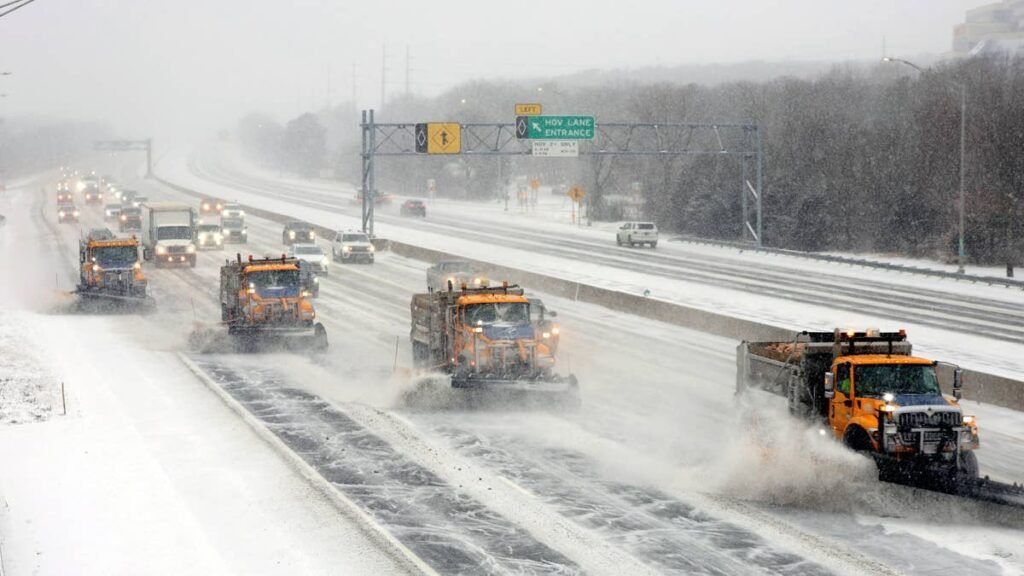
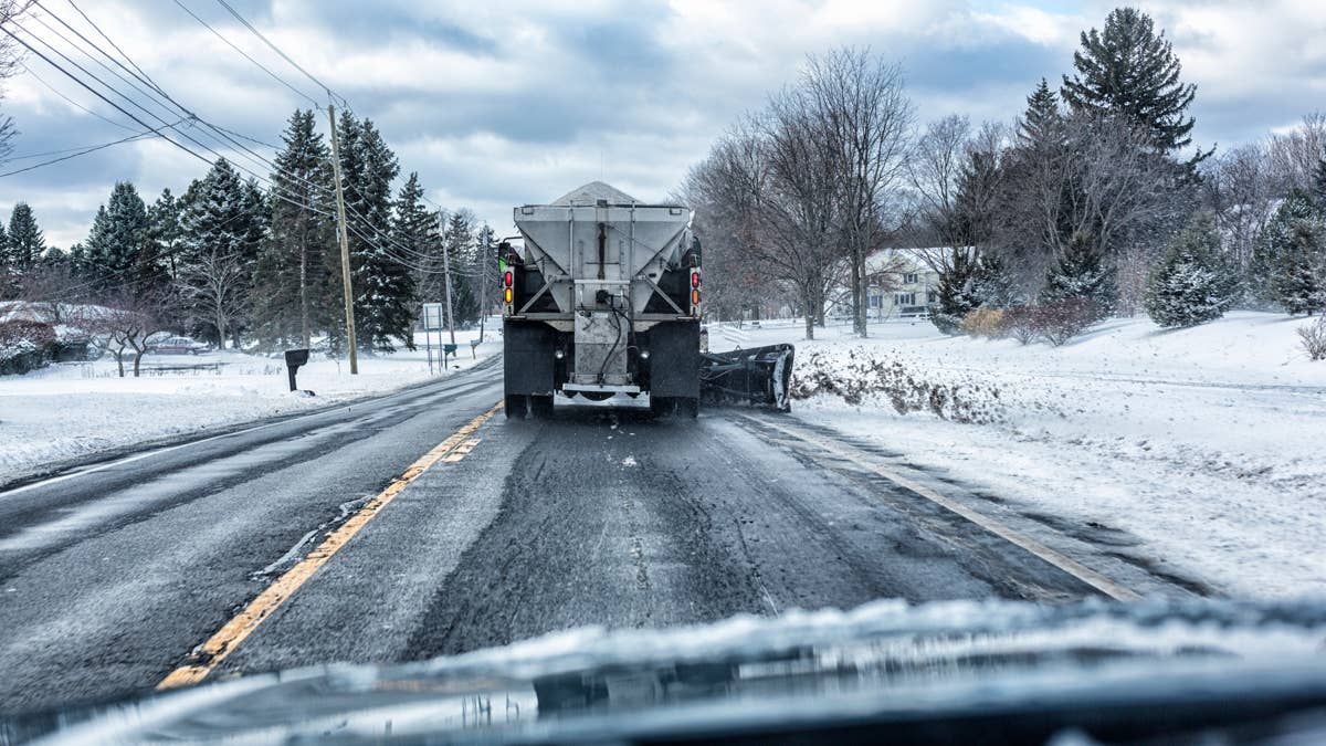
The storm isn’t at its worst yet, and the roads are already starting to close. The I-80 is already partially closed between Emigrant Gap and Alta for emergency work, and Caltrans has trucks stopped at three screening points across the summit corridor: eastbound at Applegate, westbound at Overland Trail Road in Truckee and at Mogul west of Reno. Maximum chains arre required at all three, with permit loads banned. On the other end of I-80, a high wind advisory on the Bay Bridge means campers and trailers are not recommended there either. Both ends of the road between the Bay Area and Reno are under restrictions right now, before the worst of the storm arrives.
The Winter Storm Warning runs through Monday afternoon. NWS point forecasts for Donner Pass called for 5 to 9 inches overnight, another 8 to 12 inches today (Sunday), and as much as 15 to 21 inches at higher elevations. Wind chill has dropped to -3, while crest gusts are forecast to reach 90 mph. Anyone not already in the mountains has no reason to be heading there now.
What Is Happening Right Now
The forecast called for snow levels to drop to 6,000 to 7,000 feet by yesterday evening. They got there by the afternoon instead, roughly 1,000 feet lower and several hours early. Accumulation built quickly on road segments that were getting rain Saturday morning, which is exactly the kind of fast transition that catches people mid-drive. The first of two Pacific systems came ashore Friday night and has been producing steady snowfall since. The second, which is colder and carries more moisture, arrived overnight.
NWS
I-80 is still technically open over the summit with chain controls, but there is a partial closure near Alta for emergency work and the distance between the current situation and a full shutdown is not large. In February, a similar setup closed 60 miles of I-80 from Colfax to the state line, and left hundreds of people sitting in their cars for hours. The forecast tonight is for heavier snow and stronger winds than those that triggered that closure.
What To Expect Tonight Through Monday
Today (Sunday). There is a pattern with these storms where people assume Sunday afternoon is the recovery window. It is not. Snow is continuing through the day, another 8 to 12 inches at pass level with 15 to 21 possible higher up, and wind chill is staying below zero. Road crews are still working through what fell overnight. How quickly they can reopen anything depends on whether the wind cooperates, and right now the forecast gives no reason to think it will. A full closure of I-80, if that hasn’t happened already, remains the most likely outcome before the day it out. When that happens, there is no detour across the Northern Sierra. NWS Sacramento is calling for 2 to 5 feet of total accumulation above 6,000 feet by Monday.
Monday. The snow tapers into the afternoon but compacted spring snow is heavier than midwinter powder, takes longer to plow, and refreezes overnight into a surface that can be harder to drive on than what the storm itself put down. The earliest realistic crossing window is Monday midday, more likely Tuesday morning.
The Other Highways
Highway 50 to South Lake Tahoe. Echo Summit at 7,382 feet carries the same closure risk as I-80 with fewer plowing resources. When both close at the same time, which they did in February, there is no alternative route across the central Sierra.
Highway 395 and the eastern Sierra. The highway itself gets 2 to 6 inches with gusts to 40 mph, which is manageable for a driver who is paying attention. The problem is everything west of it. Mammoth and June Mountain access roads face 6 to 12 inches on routes that are not plowed to interstate standards. Carson Pass and Highway 89 are higher, more exposed, and will close before 395 does. They are not worth planning around this weekend.
Interstate 5 through the Grapevine (Southern California). This is the part of the storm that most people have not been watching. NWS Los Angeles has issued a Winter Weather Advisory for the I-5 corridor, the San Gabriel Mountains and the Ventura and Santa Barbara County mountains, running through 11 AM Monday. Snow levels along I-5 are dropping to 4,500 to 5,000 feet tonight into Monday morning, with 5 to 10 inches possible above 6,000 feet. The Grapevine connects the Central Valley to Los Angeles. It carries some of the heaviest truck and commuter traffic in the state, and when it closes or goes to chain controls the backups are measured in hours, not minutes. Anyone driving between LA and Bakersfield Sunday through Monday morning needs to check conditions before leaving.
The Snowpack Problem
This storm is hitting bare ground. The April 1 snowpack measurement came in at 18% of average, second-lowest on record. Northern Sierra was at 6%. March was California’s warmest and driest on record and most of the existing snowpack melted weeks ahead of schedule.
For road conditions, that matters significantly. Two to five feet of heavy, wet spring snow is landing on asphalt and terrain that have been dry and warm for weeks. That snow bonds to road surfaces differently than snow falling on established pack. It freezes into a harder layer at the interface, which matters for how quickly roads come back after the storm passes. The February storm was comparable in size, but it landed on snowpack that at least existed.
Zone Forecasts
Mono County (NWS Reno, Winter Storm Warning): 2 to 6 inches west of Highway 395, 6 to 12 above 8,000 feet, up to 24 on the crest. Crest gusts to 90 mph, 40 mph along 395. Through Monday afternoon.
Lake Tahoe area (NWS Reno, Winter Storm Warning): 6 to 10 inches around the lake, 12 to 28 above 7,000 feet.
Northern Sierra / Western Plumas County (NWS Sacramento, Winter Storm Warning): 2 to 5 feet above 6,000 feet, up to 5 feet on the peaks. 2 to 4 inches possible down to 4,000 feet. Winds to 45 mph. Heaviest snow through midday Sunday, continuing Monday.
Southern California mountains (NWS Los Angeles, Winter Weather Advisory): I-5 corridor, San Gabriel Mountains, Ventura and Santa Barbara County mountains. 5 to 10 inches above 6,000 feet. Snow levels dropping to 4,500 to 5,000 feet tonight into Monday. Through 11 AM Monday.
If You Are On The Road
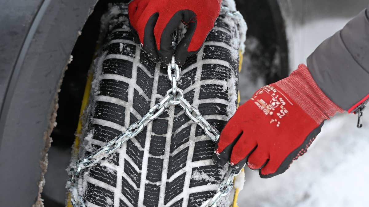
Anyone already on a mountain highway who sees conditions worsening should get off at the nearest exit, gas station or lodge. Chains are required above 4,000 to 5,000 feet and AWD does not exempt drivers from R-3 controls. Keep a full tank before entering the mountains. If stranded, stay in the vehicle and run the engine no more than 15 minutes at a time with a window cracked.
Check Caltrans for current highway conditions, chain controls and closures.