If it feels like the weather across the country is pulling in every direction at once today, that’s because it essentially is. On Monday, March 30, the United States is dealing with a multi-front weather situation that includes a late-season winter storm, a critical fire weather outbreak, severe storm potential across the Gulf South, flash flooding concerns in the Great Lakes, and mountain snow from the Pacific Northwest into the Rockies. Here is a complete breakdown of everything happening today and what it means for drivers and residents in each affected region.
Winter Storm — Northern USA
The most acute winter weather threat is centered on Northern Michigan, Upstate New York, and the higher elevations of Vermont and New Hampshire, where a Winter Storm Warning is in effect. Snowfall totals of 6-10 inches are forecast, with 40 mph wind gusts expected to produce blowing and drifting conditions throughout the day. The I-90 corridor across northern Michigan and central New York and the I-87 corridor through the Adirondacks are the primary impact highways. Icing is an added concern in northwestern Maine, where probabilities of meaningful ice accumulation are above 30 percent. While the I-95 corridor from Philadelphia to Boston is transitioning to rain thanks to warmer air moving in from the south, anyone headed inland should plan for full winter conditions.
Kyle Edward
Critical Fire Weather — Plains & Intermountain West
The National Weather Service has placed Critical Fire Weather conditions across the Southern Plains today, with the threat extending into the central Plains and parts of the Southeast through the week. A Red Flag Warning is active in Wyoming and Idaho, where wind gusts of up to 55 mph and humidity values dropping into the teens are generating rapid fire spread potential. This follows a record-scale fire weather weekend that placed nearly 50 million people under fire weather warnings across 20 states on Saturday alone. The highest remaining risks today are in Wyoming, Nebraska, and Utah. High-profile vehicle advisories are in effect along exposed highway corridors including I-80 and I-25 in Wyoming.
The Southwest and southern U.S. are also baking under unseasonably warm temperatures, with the NWS forecasting more than 100 record or near-record maximum temperatures through the end of the week and into the weekend.
Severe Weather Watch — Lower Mississippi Valley & Texas Gulf Coast
The Storm Prediction Center is keeping an eye on a line of potential severe thunderstorms pushing across the Lower Mississippi Valley and the Texas Gulf Coast today. The overall severe weather probability for Monday is relatively low at around 5 percent, but the pattern is being monitored closely as moisture returns from the Gulf. Coastal districts from Texas through Louisiana are activating contingency plans as a precaution. While a major outbreak is not expected today, the SPC has flagged a more active severe weather pattern setting up for the days ahead, with storm chances increasing across the central U.S. as the week progresses.
Getty / Douglas Sacha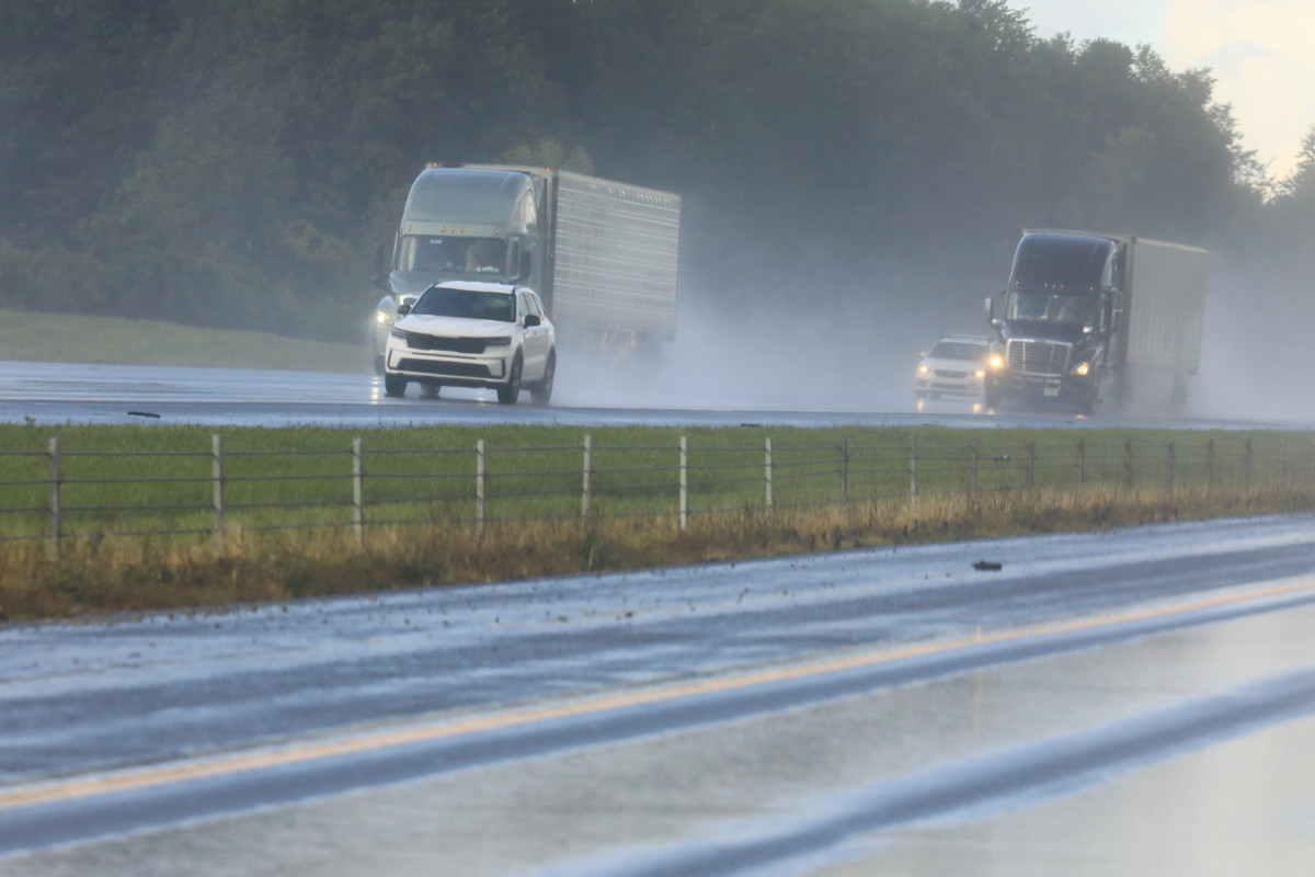
Flash Flooding — Upper Midwest, Great Lakes & Upper Northeast
A stationary boundary draped across the Upper Midwest, Great Lakes, and upper Northeast is generating a separate concern today: flash flooding. The Weather Prediction Center is tracking high moisture parameters and increasing instability along this boundary, with periodic rounds of showers and thunderstorms expected throughout the day. This is a particularly complex area where precipitation types range from snow on the northern edge to heavy rain and thunderstorms on the southern side. Drivers on I-90 and I-94 through the Great Lakes region should be aware of the potential for rapidly changing conditions.
Mountain Snow — Pacific Northwest & Northern Rockies
A sharp upper-level trough is tracking eastward through Washington and Oregon today, dropping snow levels in the Cascades down to 1,500-3,000 feet. Above roughly 3,500 feet in the Washington Cascades, there is a better than 50 percent probability of at least 6 inches of snow. Mountain pass travel on routes like US-2 and SR-20 in Washington could be significantly impacted. The system is expected to push moisture into the northern Rockies through tonight and into Tuesday, eventually spreading some snow into Wyoming and Colorado at elevation.
Highway Driving Tips for Today’s Conditions
With hazardous weather hitting multiple highway corridors simultaneously today, the fundamentals of safe highway driving matter more than usual. The first rule is following distance, on any wet, snowy, or smoke-reduced visibility stretch of highway, double it at a minimum and triple it if conditions are actively deteriorating around you.
Cruise control should be completely off in any of today’s affected regions; it cannot react to a sudden loss of traction the way an alert driver can, and on icy or slick pavement it can actually accelerate wheel spin rather than correct it. Keep your headlights on regardless of the time of day, in snow, smoke, or heavy rain, being seen by other drivers is just as important as seeing the road ahead.
If you are traveling through the winter storm zones today, Autoblog’s guide to best practices for driving in snow and ice is essential reading before you leave, covering everything from how to handle a skid to what belongs in your emergency kit.
If you are on I-80 or I-25 through Wyoming today and encounter smoke or reduced visibility from fire activity, do not slow down and stop in the travel lane, get completely off the road, turn off your lights so other drivers do not follow you thinking you are still moving, and wait it out. And no matter which region you are driving through today, keep your phone charged, your tank above half, and check your state DOT’s highway conditions page before you depart. Our winter car readiness checklist also has a full pre-trip rundown worth scanning if you are heading into any of today’s warning zones.
The Big Picture
Today’s weather pattern is a textbook late-March clash: Arctic air still fighting for territory in the North and West, while the first serious warmth of spring surges up from the Gulf and the Southwest. That collision zone is generating an unusually broad swath of hazardous conditions from coast to coast. Drivers across the northern tier, the Plains, and the Gulf South should monitor local NWS forecasts closely throughout the day, as conditions in several of these areas are expected to change rapidly.


