NOAA has published its outlook for December, January and February. Winter itself is months off, but the maps everyone’s expectations get built on are already out.
El Niño is the reason, but the effects won’t be the same everywhere. In its Aug. 13 update, NOAA put the odds of a very strong event this fall and winter above 90 percent.
Looking at NOAA’s official prediction, the thing that stands out is warmth. Above normal temperatures are favored across the northern tier and most of the country behind it. The Gulf Coast and the area around Florida sit at near normal, and the Mountain West and Intermountain West carry the equal chances label NOAA uses when warm, cold and average odds are roughly even.
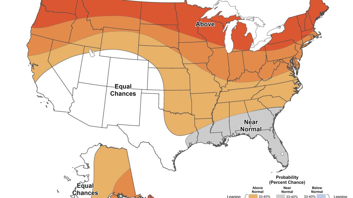
NOAA/Climate Prediction Center
Precipitation Is Where It Gets Interesting
None of that rules out cold. A seasonal outlook averages three months together, and plenty of bad winter storms have landed in seasons that finished above normal.
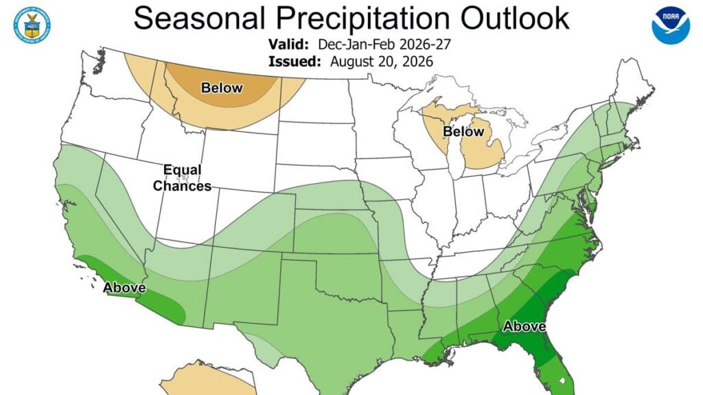
Most of the country is expected to run normal or wetter than normal this winter. The strongest wet signal runs along the southern tier, from California and the Southwest across Texas and the Gulf Coast, then up the Eastern Seaboard, with Florida carrying the highest odds on the map.
Only three areas are tilted dry: the Pacific Northwest, Michigan and the eastern Great Lakes, and part of interior Alaska. Much of the northern Plains and the Upper Midwest is marked equal chances, which is NOAA’s way of saying the models do not agree enough to call it.
For the Great Lakes that could mean less snow than usual, though a thin season on paper still leaves plenty of room for individual storms. Snow needs both maps to cooperate, and the places where they do sit mostly in the West.
What Other Forecasters Are Saying
The Old Farmer’s Almanac released its own 2026-2027 outlook on Aug. 28 and lands in a similar place on temperature, calling for a mostly mild season with a colder stretch running from central New England through the Appalachians and the Ohio Valley.
On the rest it splits the country up. Wetter than normal across much of the West and in parts of the South, Midwest and Florida. Drier than normal in parts of the East, the Plains and the Southwest. Snowier than normal in parts of the Northeast and Appalachians, parts of the West and Alaska.
The Almanac makes the same point this article is built on, and puts it better: “A milder winter doesn’t mean the cold is taking the year off.” Above normal, its forecasters note, is a relative term. It is still winter.
AccuWeather has not issued its full winter forecast yet and says that one is coming in October. Its fall outlook, published Aug. 10, gets partway there. Lead long-range expert Paul Pastelok called it plainly: “A very strong El Niño will be a dominant signal through the fall.” He said the pattern shift is big enough to move flooding, drought and tropical activity, and “even early-season snowfall.”
For drivers, the useful part of that outlook is where it puts dates on things. Snow chances climb in the Rockies through November, with Colorado, Utah and New Mexico in line for a couple of early-season events. The Cascades run the other way, with below normal early snow. AccuWeather also flags a wildcard nobody’s seasonal map accounts for: a patch of the northern Pacific running much warmer than average, which could shift storm tracks, especially along the West Coast.
What a Warm Winter Means Behind the Wheel
Rain is the easier outcome most of the time. The problem is the margin. A couple of degrees decides whether a storm leaves pavement wet or glazed, and that margin can move around inside a single storm.
A seasonal average settles nothing about any one storm. What matters on the road is the temperature the day it arrives, and a forecast leaning warm is more likely to deliver borderline days than deep cold ones. Snow that falls near freezing is wet and heavy. It lands on pavement still holding some daytime warmth, melts, and refreezes after dark. What that does to the roads along the southern tier is worth reading on its own, and the same advice applies anywhere the forecast leans warm and wet.
Timing is the other problem, and a mild forecast makes it worse. Quiet stretches are when preparation slips. Winter tires sit in the garage through December, the scraper ends up in the other car, and the first real storm catches a lot of people who have not driven on snow since February. Pick a date in October and do it then. Waiting until the weather looks like winter is how people end up mounting tires in a parking lot in January.
Final Thoughts
Warmer temperatures are the headline in NOAA’s forecast, but there is a lot of variation underneath it. Some regions are looking at more precipitation, others at considerably less, and a few could still see more snow than a normal year.
Winter still happens. It just lands differently by region this year. For a lot of the country, that means rain on most storm days and ice or snow when temperatures finally drop.