The Storm Prediction Center has flagged four consecutive days of severe weather from Saturday, April 11 through Tuesday, April 14, across the south-central United States. Sunday is the day to worry about. Dallas, Oklahoma City, Wichita, Tulsa and Joplin are in the primary threat corridor for two to three of those days, with tornadoes, large hail and damaging winds exceeding 60 mph all on the table. If you are driving I-35, I-44, I-40 or I-20 between Texas and Missouri this weekend, you need to either have a plan or pick a different departure date.
Four consecutive extended-range outlooks is not something the SPC does casually. At the Day 4-8 range, forecasters usually hedge because model confidence that far out is low. This time they are not hedging. The outlooks span all four days with what the SPC describes as a level of confidence seen only a couple of times per year. Model agreement is strong and the pattern driving the event is well-defined: a potent upper-level trough digging into the western U.S. this week, building a ridge over the East, then pushing a powerful surface frontal system through the Plains. Ahead of that front, moist southerly return flow from the Gulf will push surface dewpoints into the 60s across the southern and central Plains. That is textbook April severe weather fuel.
The Weather Prediction Center’s extended forecast discussion reads the same way: an amplified upper-level pattern this weekend into next week, a strong frontal system, heavy rainfall and severe weather potential across the south-central U.S.
The Setup
The synoptic picture is not complicated. An upper-level trough currently over the western U.S. ejects east across the central states over the weekend, dragging a strong surface cold front through the Plains. Deep Gulf moisture streams north ahead of the front and supplies the instability. Each afternoon, as surface temperatures climb and the cap erodes, thunderstorms fire along and ahead of the boundary. The threat corridor shifts northeast each day: west Texas on Saturday, central Oklahoma and north Texas on Sunday, the Midwest by Monday and Tuesday. None of that is unusual for mid-April in the Plains.
What is unusual is the duration. The same set of major interstates (I-35, I-44, I-40) runs directly through the highest-probability zone for two to three straight days. A single severe weather afternoon is one thing. Three in a row over the same highways is a different problem.
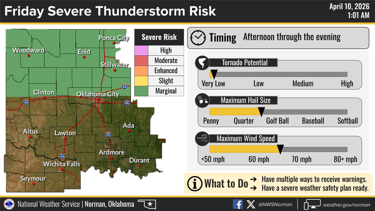
NWS Norman already has a Marginal Risk posted for northern Oklahoma this Friday, the day before the main threat window opens.
Saturday, April 11: West Texas
Strengthening mid-level southwesterly flow and a low-amplitude shortwave trough will generate scattered thunderstorms across west Texas during Saturday afternoon. Surface dewpoints in the 50s to 60s are already confirmed across Texas and Oklahoma, and a lee trough over the High Plains will serve as the primary focus for afternoon storm development. The SPC forecasts mixed-layer CAPE peaking near 1,000 J/kg with 0-6 km shear in the 30 to 40 knot range over the southern High Plains. Storm mode will likely be multicellular with straight hodographs, which favours hail and severe wind gusts over tornadoes.
Highways at risk: I-20 from Midland-Odessa to Abilene, I-27 from Lubbock to Amarillo, US-84 and US-87 across the southern High Plains.
Sunday, April 12: The Day That Matters
This is the day the SPC is watching most closely, and it is the day drivers need to take seriously.
Strong moisture advection overnight Saturday pushes deep Gulf moisture across the Great Plains. By Sunday afternoon, moderate instability should be in place over much of the moist sector, and the updated Day 4-8 outlook issued April 9 has strengthened the language considerably. The greatest potential for severe storms will likely be in the southern and central Plains, with moderate deep-layer shear and steep lapse rates favourable for supercells with large hail and severe wind gusts. A 50 to 60 knot mid-level jet pushing through central and northeast Texas during the afternoon and evening would add a tornado threat on top of that. How far the jet penetrates and how quickly storms go linear will determine whether Sunday is a notable severe day or a genuinely bad one, but the conditional hedging from Tuesday’s outlook is mostly gone now.
The tornado risk is highest where the low-level jet intersects surface boundaries across central Oklahoma and north-central Texas, particularly if discrete supercells maintain rotation before storms consolidate into a line. NWS Norman and NWS Fort Worth will carry the local warnings for that zone.
The highway exposure on Sunday is the core concern:
- I-35 from Dallas through Oklahoma City to Wichita. This is the most exposed corridor in the entire event. A discrete supercell crossing I-35 in Oklahoma during the afternoon or evening can produce hail large enough to shatter windshields and wind strong enough to push a truck out of its lane.
- I-44 from Oklahoma City through Tulsa to Joplin, right where the warm-sector moisture is richest.
- I-40 from Oklahoma City toward Little Rock. Storms moving east off the dryline will cross this road repeatedly through the evening.
- I-30 from Dallas to Little Rock, the southern edge of the primary threat.
- I-20 across east Texas into Louisiana if storms propagate south.
Monday, April 13: Northeast Shift
Same airmass, different geography. Moderate instability should be in place from north Texas northward into the upper Mississippi Valley by Monday afternoon, and storms are again expected with all hazards active: hail, damaging winds, tornadoes. The axis shifts northeast, which puts I-44 from Tulsa toward Springfield in the path, along with I-70 across Missouri, I-49 from Fort Smith through Joplin into Kansas City. The I-55 and I-64 corridors across the Mississippi Valley pick up secondary risk. If Sunday underperforms, Monday may not, and vice versa. The pattern supports both days.
Tuesday, April 14
Confidence is lower by Tuesday but the threat has not been dropped. The western U.S. trough is forecast to finally approach the southern Plains, where a moist and unstable airmass should still be in place. Some model solutions suggest a mid-level jet arriving Tuesday afternoon, which would create enough deep-layer shear to support supercells with large hail, severe gusts and tornadoes. Whether that actually happens depends on details that are hard to resolve at this range, and the spatial uncertainty is still considerable. But the outlooks are still up, which at Day 7 tells you something.
If You Are Driving
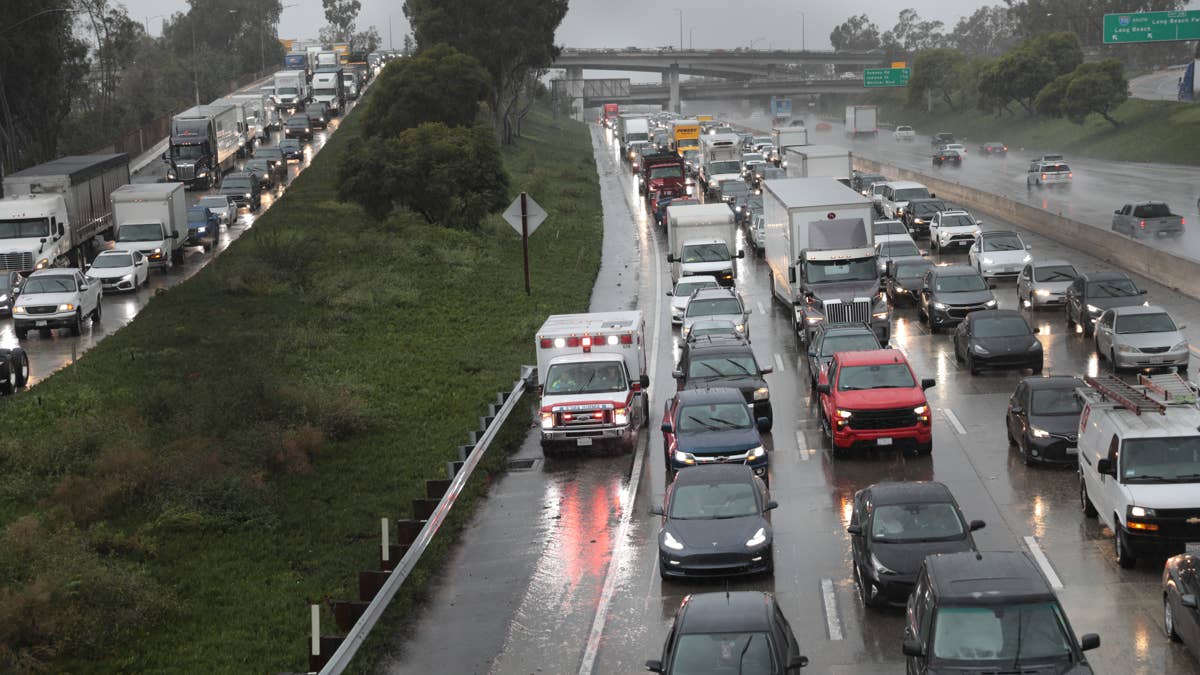
This is four days of afternoon and evening severe thunderstorms across a corridor that shifts from west Texas to the Midwest. There is no clean travel day in that window. There are only narrower gaps.
Best option: leave Friday before the first storms develop, or wait until Wednesday. If you cannot do either, travel before noon local time. The strongest storms each day will peak in the afternoon and evening, which is also when most people are on the road, which is the whole problem.
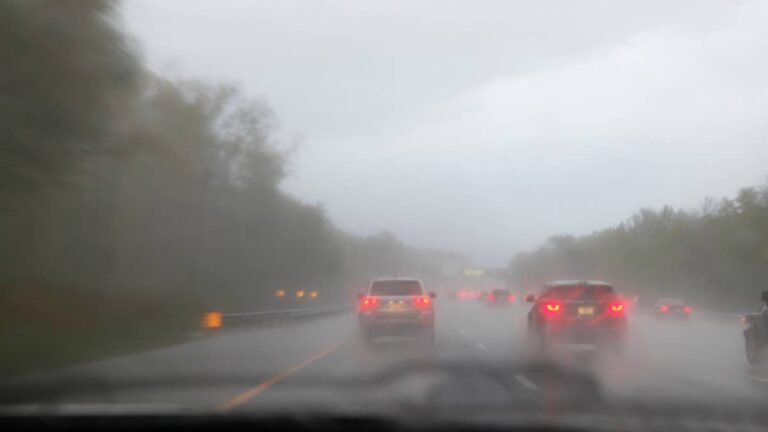
If storms catch you on the highway, get off at the nearest exit or gas station and wait. Do not drive into a wall of rain or hail. Supercell hail can exceed two inches in diameter, which is enough to total bodywork and blow out a windshield. If you see rotation or a funnel, get off the road immediately and into a sturdy building. If there is no building, a ditch or low area away from your vehicle.
High-profile vehicles (trucks, SUVs, anything being towed) are at real risk from gusts over 60 mph. Driving one of those on I-35 or I-44 during active storms means accepting the possibility of a rollover. Rain rates in supercells can hit three inches per hour, which is enough to hydroplane even good tyres.
Keep your phone charged. Keep NWS Wireless Emergency Alerts on. They push Tornado Warnings directly to your phone and they are the fastest public alert system available.
Getty Images
What To Carry
If you are driving through the threat corridor this weekend: full tank of fuel before you enter the affected area, portable phone charger, flashlight, water, food, blanket, first aid kit. Check your tyres before you leave. Worn tyres in heavy rain are a problem that compounds fast.
When Forecasts Get Specific
Everything above is based on the Day 4-8 outlook issued April 9, which upgraded confidence from the previous day’s version. The SPC will issue Day 1 and Day 2 outlooks with specific risk contours and probability areas starting Friday morning. Those are the products that include detailed tornado, hail and wind probabilities. Watch for upgrades from Slight Risk to Enhanced or Moderate Risk, especially for Sunday. NWS offices in Norman, Fort Worth and Wichita will issue Hazardous Weather Outlooks and eventually Watches as the event gets closer.